

Top States to Check Road and Traffic Conditions This Winter

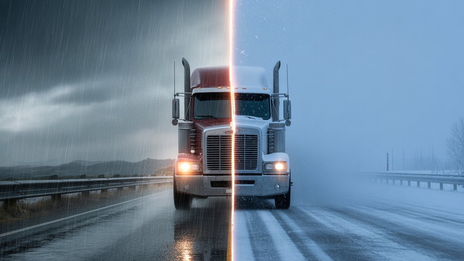
The road doesn’t care if you’re tired, late, or halfway through your coffee. It won’t wait for you to wake up or catch up. When winter hits, it hits fast. And while every state gets its share of bad weather, some make it harder than others. Ice shows up before the warning signs do, and not every route gets the same attention.
Here’s where to check road conditions before the miles get messy.
Key Facts:
- Santiam Pass in Oregon sits at approximately 4,817 feet elevation and frequently requires chains or traction tires in winter conditions.
- North Dakota Highway 83 experiences recurring whiteouts and black ice conditions, especially near Minot and Bismarck corridors.
- Wyoming reports about 34 fatal crashes per million drivers, one of the highest rates in the United States.
- Interstate 70 in Colorado climbs above 11,000 feet at the Eisenhower Tunnel and is subject to frequent winter chain and traction restrictions.
- Minnesota’s I-94 corridor near the Twin Cities regularly experiences black ice and multi-vehicle pileups during winter storm events.
- Iowa I-80 and I-35 corridors are prone to sudden snow squalls and freezing rain that can cause near-zero visibility shutdowns.
Oregon’s Mountain Passes
Start in the Pacific Northwest, where beauty meets brutality. Oregon’s mountain passes, like Santiam and Snoqualmie, are postcard-perfect until the snow hits. Santiam Pass, sitting at 4,817 feet, is one of the most unpredictable stretches in the Cascades.
This year, a crash near the summit shut down the highway for hours. Drivers were stuck with nowhere to go, and some had to wait for tow crews to clear the wreckage before traffic could move again.
That stretch of Highway 20, which includes Santiam Pass, isn’t just known for weather-related shutdowns. It also ranks high for wildlife collisions. Between Bend and Suttle Lake, drivers report up to 600 deer and elk hits per year. The mix of elevation, sharp turns, and animal crossings makes this route unpredictable in more ways than one. TripCheck from the Oregon Department of Transportation shows live road conditions, chain requirements, and camera feeds. Drivers have spun out near Santiam after hitting black ice they didn’t see coming. Chains or traction tires are often mandatory.
Before heading into Oregon’s mountain terrain, toss chains, warm gear, and emergency supplies in your rig. Weather flips fast up there, and Santiam doesn’t give second chances.
North Dakota’s Open Roads
Roll east into North Dakota, where the roads stretch flat and long. But in winter, that calm doesn’t last. In November 2025, a rollover crash on icy Highway 53 turned deadly and shut down traffic for hours.
U.S. Highway 83 sees even tougher conditions. It runs through Minot and Bismarck and is known for whiteouts, black ice, and sudden closures. Drivers say it’s one of the hardest winter routes in the state.
You May Also Like: Top Deadly Highways in the US Every Trucker Must Know

When visibility drops, the North Dakota road conditions map becomes essential. It shows road surfaces, traffic conditions, and weather forecasts in real time, helping drivers make quick decisions before things get worse. That kind of information can be the difference between making it through or getting stuck in a whiteout.
But even with good intel, you still need to be ready for the worst. Pack a full emergency kit with blankets, snacks, and water. Winter driving here is all about caution.
Wyoming’s Winter Highways
Head south into Wyoming, where wide-open highways come with serious risks. In February 2025, a truck crash and pileup in the I-80 tunnel left multiple drivers stranded.
Wyoming has some of the toughest winter driving in the country. It sees 34 fatal crashes per million drivers, nearly nine times the national average.
The state’s road report helps drivers stay ahead of trouble. It shows closures, snowpack levels, and traction advisories. Live cameras on key passes like Teton and South Pass give a real-time look at conditions.
Chains are required in the mountains. Fuel up early, winterize your rig, and pack extra gear. If you get stuck out there, help isn’t always close.
California’s Mountain Routes
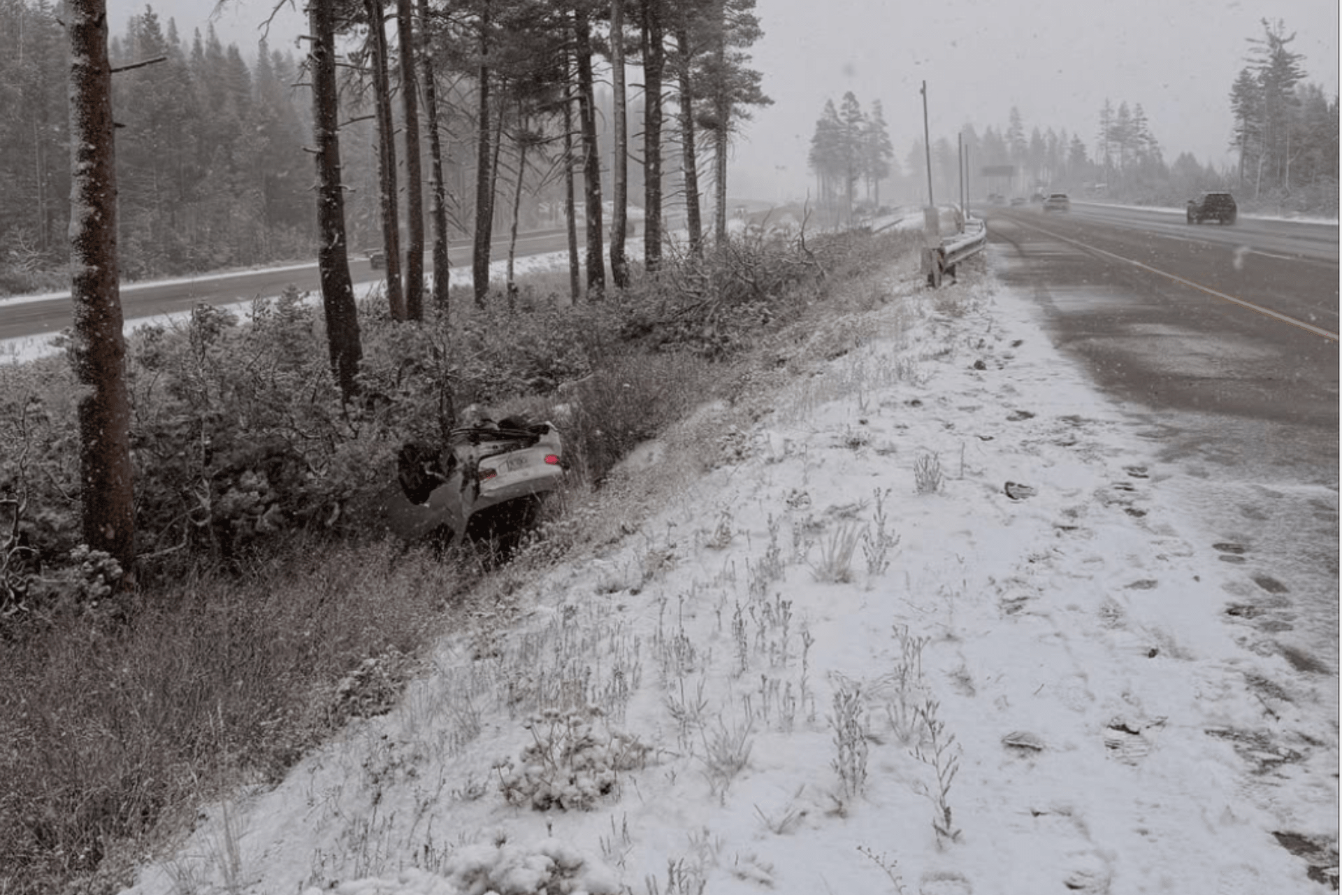
Swing west into California, where winter driving surprises even locals. In October 2025, CHP Truckee posted a photo of an overturned car on I-80 near Donner Summit. This came just days after warning drivers about slick roads. That stretch climbs fast, and early-season storms roll in without much notice. Elevation shifts, shaded curves, and black ice make Donner one of the trickiest spots in the Sierra.
You May Also Like: What to Do When Your Truck Needs a Tow in Icy Weather?
Highway 99 in the Central Valley is one of California’s deadliest stretches. It has high fatality rates per mile due to poor lighting and narrow lanes.
Caltrans posts California road conditions, chain control zones, and wildfire detours. It’s especially useful in places like Mammoth Lakes and Truckee, where elevation changes fast and storms hit hard.
If you’re heading into higher elevations, chains or winter tires are a must. Check the map before you go. Conditions can flip fast, and once you're in the mountains, there aren’t many safe places to pull off.
Iowa’s Snowy Interstates
In March 2025, pileups shut down parts of I-35 and I-80 when visibility dropped to near zero. These highways cut straight through the state and are known for sudden snow squalls and freezing rain that catch drivers off guard.
These highways cut straight through the state and carry heavy freight year-round. But when the weather turns, they become unpredictable. Snow bands sweep in without warning, and black ice forms in spots that looked dry just minutes earlier.
Around Des Moines and Council Bluffs, the mix of urban traffic and slick pavement makes things even more complicated. Interchanges clog quickly, and even short delays ripple across the network.
To stay ahead of it, the Iowa DOT road conditions map is a solid tool. It shows snow routes, plow progress, and icy zones in real time. Drivers use it to time fuel stops, reroute around trouble spots, and avoid getting caught in the next shutdown. In a state where winter hits hard and fast, that kind of detail makes all the difference.
Minnesota’s Icy Corridors
Slide north into Minnesota, where the cold bites harder and the roads get mean. By early November 2025, the state had already logged 324 traffic deaths, many tied to winter weather. Snowstorms here don’t just slow you down. They shut things down completely.
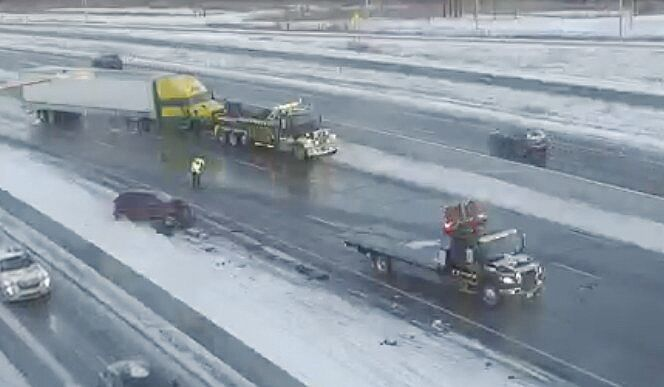
One of the toughest stretches is I-94 near St. Cloud and the Twin Cities. It’s known for black ice, sudden lane closures, and crashes that unfold in seconds. That danger showed up again in February 2025, when a crash near Monticello backed up traffic for hours. Two semi-trucks, a compact car, and an SUV driven by a local man were involved. The road was slick with ice, and visibility was low when the vehicles collided near milepost 190.
You May Also Like: How to Drive a Semi-Truck in Winter? 5 Proven Steps
That’s why Minnesota’s DOT road weather map is worth checking before every trip. It shows crash alerts, live traffic feeds, and weather overlays that help you see what’s coming. When conditions shift fast, having that kind of detail makes all the difference. It lets you time your stops, reroute early, and avoid getting caught in the next pileup.
In a state where winter hits hard and often, staying ahead of the road is the only way to stay safe.
Colorado’s High Passes
Now let’s climb into Colorado, where mountain driving takes everything up a notch.
A month ago, snowy conditions shut down the eastbound lanes of Interstate 70 at the Eisenhower Tunnel for 45 minutes. Traffic backed up quickly, and drivers had to wait it out while crews cleared the slick pavement and got things moving again. That stretch between Vail Pass and the tunnel is one of the most unpredictable in the state. It sees frequent closures, rockslides, and sudden squalls that catch even seasoned drivers off guard.
Loveland Pass is another trouble spot. It’s steep, exposed, and often hit with sudden snow squalls. If you’re not running traction gear here, you’re asking for trouble.
Colorado’s road conditions map is a must. It shows avalanche zones, traction laws, and live cams so you can see what’s ahead. Before heading into the high country, make sure you’ve got chains, warm gear, and a full tank. Storms roll in fast and don’t wait for anyone.
Montana’s Long Drives
Roll into Montana, where winter driving is less about elevation and more about isolation.
US-93 is one of the state’s deadliest highways, especially near Kalispell and Missoula. Wildlife crossings, winding terrain, and patchy ice make it a tough ride even in daylight. That risk showed up again in January 2025, when a crash north of Missoula near Evaro backed up traffic in the southbound lanes for hours.
A commercial vehicle jackknifed on icy pavement, crossed the center line, and collided with an oncoming SUV. Two people were killed at the scene, and the highway was shut down while crews responded.
You May Also Like: Shocking Facts: How Many Semi-Truck Drivers Die Annually in the U.S.

Further east, I-90 sees a different kind of trouble. Snowstorms hit hard near Bozeman and Billings, and when conditions go south, detours can stretch for miles. Long-haul drivers know that once you're out there, options get limited fast. Cell service drops off, fuel stops thin out, and weather can shift without warning.
Montana’s DOT shares an interstate road status map that flags closures, snow emergencies, and traction advisories. It’s built for long-haul planning, especially when you’re crossing remote stretches. Before you head out, check the Montana road condition updates and pack extra fuel and supplies.
Kansas’s Windy Roads
The wide-open stretches of I-70 are known for black ice and sudden whiteouts, especially between Salina and Colby. Drivers often underestimate these rural routes because the terrain looks predictable. But when a cold front sweeps in, visibility drops and traction disappears quickly.
The Kansas Department of Transportation provides a winter road conditions map that’s worth checking before every trip. It flags icy zones, closures, and wind chill advisories. These updates matter more than you might expect when you're stuck roadside in freezing temperatures.
Highways like US-54 and US-400 see frequent winter crashes, especially near Wichita and Dodge City. In January, a major storm swept through Kansas, and icy conditions near Wichita triggered multiple crashes and slide-offs. Footage from the scene shows drivers losing control as the roads glazed over and visibility dropped.
Flat terrain doesn’t make it easier. Black ice forms fast, and once it’s there, even short trips can turn dangerous. In Kansas, checking the road weather map before you roll out is how you stay ahead of trouble.
New Mexico’s Steep Grades
As you move southwest into New Mexico, elevation becomes the wildcard. You might start your day in sunshine and end it in a snowstorm. Northern routes like US-64 and US-285 climb into the mountains, where snow and ice can shut down roads with little warning.
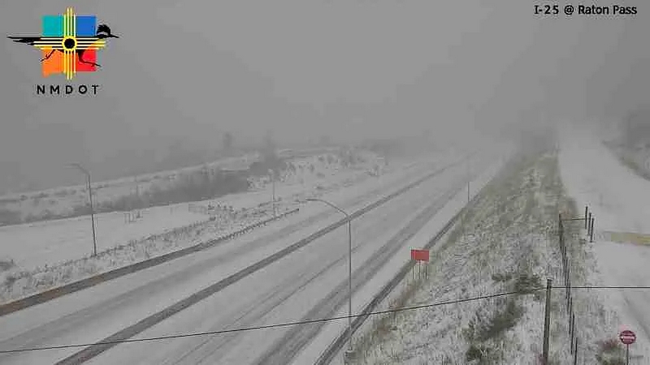
Even I-25 near Raton Pass turns slick and unpredictable when cold fronts sweep through. On November 4, 2025, a heavy snow and wind event shut down the interstate near the Colorado line. Several inches of snow fell fast, visibility dropped to near zero, and the pass became a no-go zone. Traffic was halted for hours while crews worked to clear the road and help stranded drivers.
You May Also Like: Doppler Weather Radar: The Secret Behind Smarter Forecasts
That stretch of I-25 is a lifeline between New Mexico and Colorado, and when it shuts down, detours are long and cell service is spotty. Drivers heading north through Raton know to check the road weather map before climbing the pass.
The New Mexico Department of Transportation provides a highway report and road conditions map that helps drivers navigate these shifts. It shows road closures, icy patches, and alerts across the state’s mix of desert flats and mountain passes.
Drivers heading toward Santa Fe or Taos often hit sudden drops in traction, especially after dark. The terrain shifts quickly, and the weather can turn just as fast. Chains or winter tires are a smart move, even if you're not climbing into the Rockies. Out here, staying ready means knowing the road can change without warning.
It’s the same story across the region. Every state has its own risks. The smart move is knowing what’s coming and planning for the worst. Use the state maps. Watch the road cams. Pack extra gear. And don’t rush it, as winter driving rewards patience, not speed.


