

Doppler Weather Radar: The Secret Behind Smarter Forecasts

Weather radar is a key tool that helps millions across the United States keep track of the weather. If you want to avoid getting caught in the rain or prepare for a big storm, knowing how radar works can give you an edge.
We’ll cover what weather radar is, how it works in the U.S., the different radar maps, and why live radar matters to everyone. Let’s start with the basics.
Quick Summary:
- The U.S. uses about 155 NEXRAD Doppler radar stations to track storms and precipitation nationwide.
- Radar updates typically refresh every 4–6 minutes, providing near real-time weather movement data.
- Doppler radar can detect both rain/snow intensity and wind rotation inside storms for severe weather alerts.
- Reflectivity, velocity, and precipitation type are the three main radar map outputs used for driving and safety decisions.
- Radar coverage gaps can occur within about 0–10 km of mountains or large obstacles due to signal blocking.
- Weather radar data is combined with satellite systems updating roughly every 5–15 minutes for full U.S. coverage.
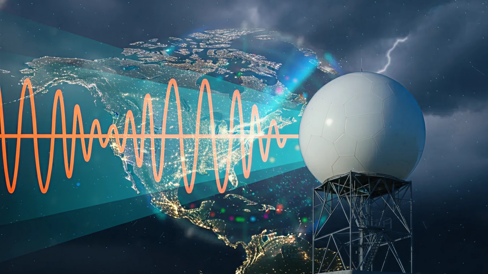
What Is Weather Radar?
Weather radar is a system that sends out radio waves into the sky. These waves bounce off rain, snow, or hail and return to the radar. The radar uses these signals to figure out where the precipitation is, how heavy it is, and how fast it’s moving.
You May Also Like: Improve Route Safety with Real-Time Road and Weather Updates

Most radar stations in the U.S. use Doppler radar. This type can detect wind movement inside storms, which helps identify dangerous weather conditions such as tornadoes or flash floods. Thanks to this technology, weather forecasts have become much more accurate.
Radar isn’t perfect, though. Sometimes mountains, buildings, or heavy rain can block the signals, causing gaps in coverage. That’s why meteorologists use data from many radar stations and satellites to get the full picture.
How Does the U.S. Weather Radar System Work?
The U.S. has numerous radar stations located throughout the country. These stations send out radio waves that spin around, scanning the sky in all directions.
When the waves hit precipitation, the radar gets the signal back and creates a map showing the weather. Doppler radar also measures wind speed and direction, which helps predict where storms are heading.
Meteorologists combine radar data with satellite images to cover places where signals might be blocked by hills or buildings. This way, the radar system gives reliable weather information almost everywhere.
Technology keeps improving, making live radar updates faster and more accurate. That means you get better information to plan your day or stay safe during storms.
Types of Weather Radar Maps
Radar data comes in several map types. Each one gives a different view of the sky and helps you understand what is happening.
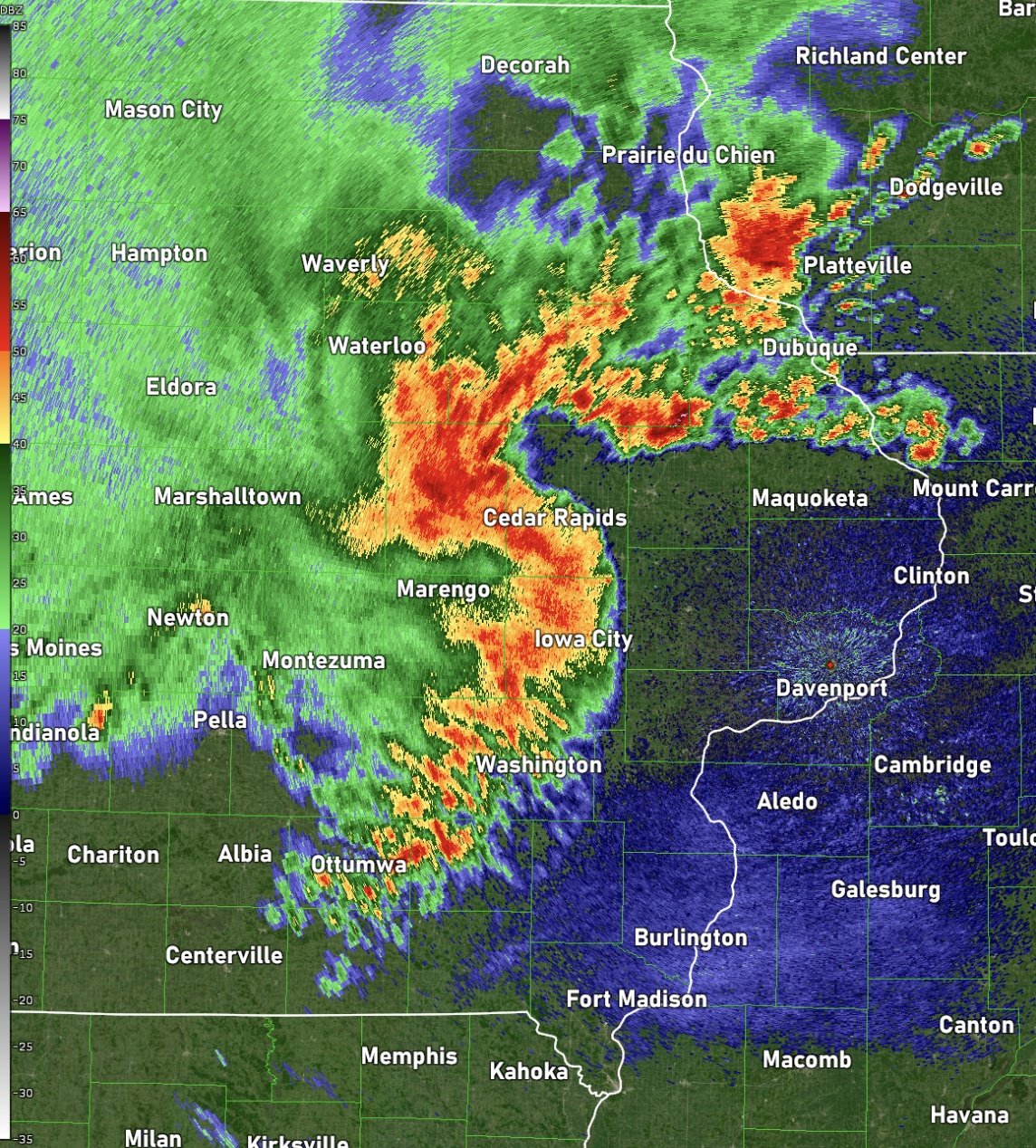
- Reflectivity Maps
These maps show how much precipitation is falling in a certain area. The radar measures the energy bounced back from raindrops, snowflakes, or hailstones.
Bright colors on the map mean heavy precipitation, like strong rain or hailstorms. Lighter colors mean light rain or drizzle. Reflectivity maps are great for seeing where rain is strongest and how widespread a storm is.
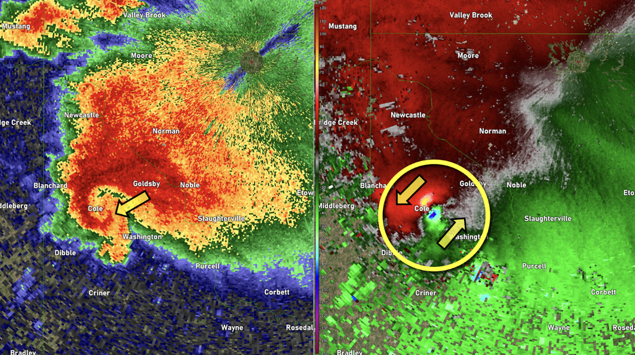
- Velocity Maps
Velocity maps track the movement of wind inside storms. Radar sends out waves and measures how the wind pushes these waves toward or away from the radar station.
By looking at this data, meteorologists can spot spinning winds that might form tornadoes or severe gusts. These maps show patterns of wind speed and direction, which are important for giving early warnings about dangerous conditions.
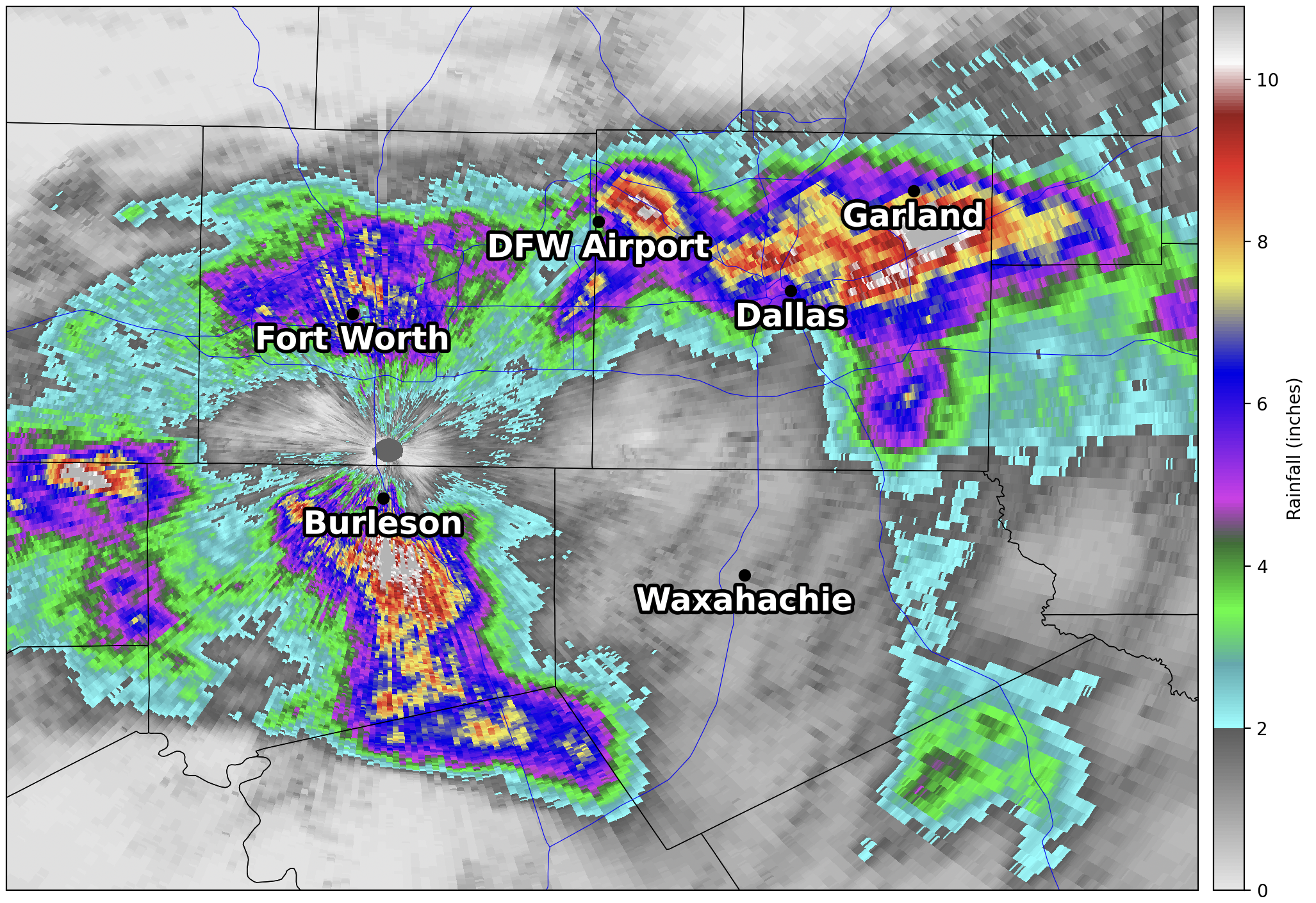
- Precipitation Maps
These maps help identify what kind of precipitation is falling, whether it is rain, snow, sleet, or freezing rain. This matters a lot in places with cold weather, where knowing the difference can mean staying safe on the roads.
For example, freezing rain looks like rain but can freeze on contact, creating icy surfaces. Precipitation type maps use radar data along with temperature readings to show exactly what is falling from the sky.
You May Also Like: What Wind Speed Is Dangerous for Semi-Trucks?
Knowing how to read these maps helps you understand how serious the weather is and what to expect.
Practical Uses of U.S. Weather Radar
Weather radar is important for many people, not just weather experts. It helps different groups in their daily work and personal lives. From flying planes to farming crops, radar provides key information that keeps people safe and prepared.
Let’s look at who uses radar and why it matters so much.
- Pilots depend on radar to spot storms early and choose safe flight routes, helping avoid turbulence and delays.
- Farmers use radar to monitor storms and dry spells, protecting crops and planning irrigation.
- Emergency workers rely on radar to prepare for and respond quickly to disasters, keeping communities safe.
- Mariners use radar to navigate safely through storms and changing sea conditions.
- Outdoor event planners check the radar to avoid surprises and keep events running smoothly.
- Drivers use live radar to adjust travel plans and stay safe on the road.
In short, anyone can check live radar to stay informed and make smart choices every day. Weather radar is a powerful tool helping keep the U.S. safe and prepared. Understanding how it works and using live updates puts you a step ahead.
Keep an eye on the radar and stay ahead of the weather. It’s one of the easiest ways to be ready for whatever comes next.


