



Live Road Cameras: Plan Your Route with Trucker Guide

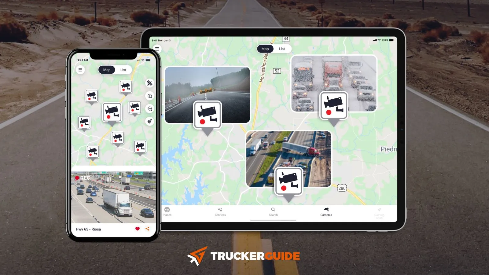
Trucker Guide gives drivers real-time access to more than 80,000 live road cameras across the U.S. and Canada, including official DOT feeds in all 50 states. Through the app or web platform, drivers can quickly check current traffic flow, weather conditions, and road status before and during their route, helping them plan ahead and avoid delays on the road.
What makes this especially powerful in practice is how that real-time visibility translates directly into what you see on the road ahead.
Quick Summary:
- Trucker Guide provides access to over 80,000 live road cameras across the U.S. and Canada, recently expanded with 1,000 new feeds.
- Live camera views help drivers monitor traffic incidents, congestion, and lane closures before reaching them.
- Cameras also give real-time visibility into road hazards like steep grades, sharp curves, and high-risk zones.
- Weather conditions such as rain, snow, wind, and visibility can be checked to improve route safety decisions.
- State DOT camera systems (e.g., MS, CT, SC, RI, UDOT) provide reliable real-time traffic data for key freight regions.
- Major highways like I-25, I-75, I-80, and I-95 are commonly monitored due to heavy traffic, weather changes, and freight importance.
How Do Live Road Cameras Help Truck Drivers Plan a Route?
This feature is especially useful when you’re on a tight schedule. Street cameras let you see traffic slowing near major interchanges, accidents blocking lanes, or heavy merging in work zones before you get there. That way, you can decide whether to stay on your route, shift lanes early, or take a short stop to avoid long delays.
The feeds also give a clear view of areas that usually require extra caution, such as steep grades, sharp curves, or high-incident stretches. Instead of relying only on alerts, you can see the actual traffic flow and adjust speed smoothly, maintain safe distances, and reduce wear on brakes and tires.
The weather is another key factor. Checking visibility, precipitation, and wind along your route gives a realistic picture of road conditions. This helps you decide whether to keep moving, slow down in advance, or stop safely if conditions worsen.
You May Also Like: Improve Route Safety with Real-Time Road and Weather Updates
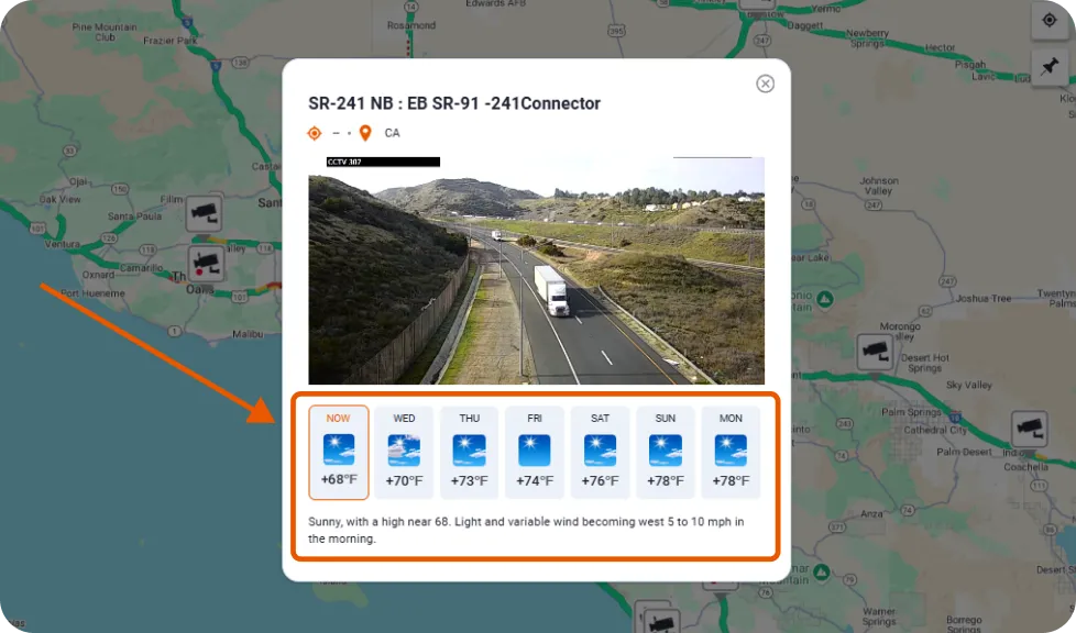
To make staying updated even more convenient, Trucker Guide offers a dedicated Trucker Guide Road Condition Forecast group. It keeps you informed about the latest weather updates and road alerts so you can make smarter decisions for every mile of your journey.
Having traffic, road, and weather visibility all in one place helps drivers avoid surprises and make calmer, better-timed choices on the road. That brings us to the locations truckers need to pay the most attention to this week.
Trending Traffic Camera Locations This Week
From October 19–25, 2026, roadwork and changing traffic patterns may affect truck routes across several states. Checking live cameras and official road alerts before departure can help drivers prepare for delays and avoid unexpected detours.
Traffic cameras in Bellevue can help drivers assess congestion around major intersections and highway connections. Before traveling through the area, check Bellevue traffic advisories for active closures and construction updates, particularly where overnight work could affect access to local roads.
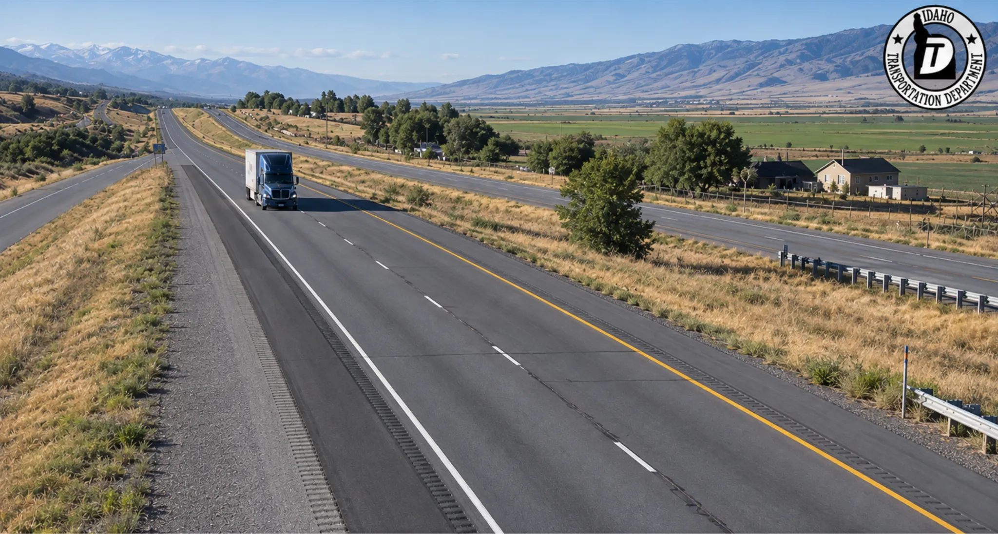
In Idaho, westbound I-90 traffic near Post Falls and Coeur d’Alene is shifting to the south side of the interstate on October 21. The westbound SH-41 off-ramp is scheduled to close nightly from October 21–23, between 8 p.m. and 5 a.m. Drivers should check Idaho traffic cameras for current conditions, detour information, and changes around the work zone.
West Virginia drivers should also prepare for construction-related delays. Paving on I-77 in Kanawha County is scheduled through October 21 between mile markers 102.4 and 101.2, with additional northbound lane restrictions planned for October 21–22. Traffic cameras in WV can help drivers assess visible traffic conditions, while WV 511 provides updates on reported incidents and travel delays.
Where Can Truck Drivers Check DOT Traffic Cameras Right Now?
Road conditions can change quickly in October, particularly when construction overlaps with seasonal weather. For truck drivers, checking live traffic cameras before departure is a practical way to assess traffic flow near interchanges, bridges, and other potential bottlenecks. Live camera feeds are useful for checking congestion near interstate interchanges and construction zones, but drivers should also confirm scheduled closures through official road advisories. This is especially important for semi-trucks approaching overnight work zones or planning detours.
In Delaware, construction at the I-95 and Route 896 interchange includes scheduled lane and ramp restrictions from October 19–23. Drivers can use DelDOT cameras to assess traffic near the interchange and review the project's closure updates before approaching the work zone.
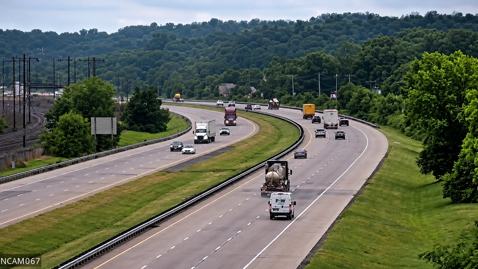
In Rhode Island, overnight bridge work at the I-95 and Route 10 interchange at Exit 33 affects traffic around Providence and Cranston. Additional work is scheduled for October 23–24, while a separate traffic shift on I-95 North near Exit 31C is expected to remain in place for approximately two months. RIDOT road cameras can help drivers check congestion near these approaches. For closure details, consult the official I-95 bridge project updates.
In Hawaii, GoAkamai traffic cameras provide live views of major roads, particularly on Oʻahu. Drivers can use Hawaii DOT’s lane-closure map alongside traffic cameras to identify restrictions and anticipate delays. Since camera footage only captures conditions at a specific moment, official road advisories are essential for staying informed about closures and choosing alternative routes suitable for their vehicles.
Which Interstate Highways Have the Most Active Camera Monitoring?
Some highways always get extra attention because of how long they are, how busy they get, or the tricky weather they can bring. Watching interstate cameras along these routes gives drivers a clear picture of what’s happening on the road, so they can plan smarter and stay safer.
Here are a few that are especially important:
- I-25 runs north to south through Colorado, Wyoming, and New Mexico, connecting major freight hubs like Denver, Colorado Springs, and Cheyenne. The route crosses a mix of urban corridors, open plains, and higher-elevation stretches where weather conditions can change fast, especially during winter and early spring.
Using I-25 traffic cameras helps drivers check current pavement conditions, monitor traffic flow, and spot incidents before heading into congested metro areas or exposed stretches where weather can create unexpected delays.
- I-75 – Stretching from the Great Lakes down to Florida, I‑75 passes through diverse terrain and weather zones, including heavy rain in the south and occasional snow or ice in the north.
Monitoring traffic cameras along I-75 allows drivers to verify pavement conditions, visibility, and traffic flow before committing to long stretches between major hubs.
- I-80 – One of the most important east–west freight corridors in the country, I-80 runs from California all the way to New Jersey, cutting through a mix of flat plains, mountain passes, and high-elevation stretches. That variety is exactly why conditions can change so fast depending on where you are on the route.
Using I-80 traffic cameras is especially useful in places like Nevada, Utah, Wyoming, and Pennsylvania, where the weather can change quickly, and visibility can drop with little warning. One section might be clear and dry, while just a few miles ahead, you could be dealing with snow, fog, or heavy wind.
- I-95 – One of the busiest north–south highways in the United States, I-95 runs from Florida to Maine, passing through major cities like Washington, D.C., Philadelphia, New York City, and Boston. Drivers can encounter heavy traffic, construction delays, and seasonal weather conditions along the route. Use I-95 traffic cameras to check real-time traffic flow, visibility, and road conditions, spot potential delays, and plan safer, more efficient trips.
Before your next trip, take a few minutes to check the Trucker Guide’s DOT cameras live. A small investment of time now can save hours on the road, reduce stress, and keep both you and your rig safe.
Stay aware, stay prepared, and keep moving with confidence.
Frequently Asked Questions
Which app shows live road cameras for truck drivers?
Trucker Guide provides access to thousands of live DOT and highway camera feeds across the U.S. and Canada, making it one of the most complete tools for real-time road visibility in a single platform.
Can I see live highway cameras before I start driving?
Yes. Drivers can check live feeds before a trip to see traffic flow, weather conditions, and incidents along the route, helping them choose better timing or adjust plans before departure.
How is Trucker Guide different from 511 traffic systems?
Unlike many state-only 511 systems, Trucker Guide combines multiple DOT feeds and highway cameras across all states and Canada in one platform, giving drivers broader, unified access instead of switching between state sites.
How do I check road conditions on a specific state or city before my trip?
You can search live camera feeds by highway, region, or location in the app or web platform to quickly see real-time traffic and weather conditions before you start driving.
Does Trucker Guide have traffic cameras in Canada?
Yes. The platform includes live road camera coverage across both the U.S. and Canada, helping drivers monitor cross-border routes and major freight corridors.
Do I need a paid subscription to access live traffic cameras in Trucker Guide?
No. Live camera access is available directly through the platform, allowing drivers to check road conditions without requiring a paid subscription.


