



Live Road Cameras: Plan Your Route with Trucker Guide


Trucker Guide gives drivers real-time access to more than 80,000 live road cameras across the U.S. and Canada, including official DOT feeds in all 50 states. Through the app or web platform, drivers can quickly check current traffic flow, weather conditions, and road status before and during their route, helping them plan ahead and avoid delays on the road.
What makes this especially powerful in practice is how that real-time visibility translates directly into what you see on the road ahead.
Quick Summary:
- Trucker Guide provides access to over 80,000 live road cameras across the U.S. and Canada, recently expanded with 1,000 new feeds.
- Live camera views help drivers monitor traffic incidents, congestion, and lane closures before reaching them.
- Cameras also give real-time visibility into road hazards like steep grades, sharp curves, and high-risk zones.
- Weather conditions such as rain, snow, wind, and visibility can be checked to improve route safety decisions.
- State DOT camera systems (e.g., MS, CT, SC, RI, UDOT) provide reliable real-time traffic data for key freight regions.
- Major highways like I-25, I-75, I-80, and I-95 are commonly monitored due to heavy traffic, weather changes, and freight importance.
How Do Live Road Cameras Help Truck Drivers Plan a Route?
This feature is especially useful when you’re on a tight schedule. Street cameras let you see traffic slowing near major interchanges, accidents blocking lanes, or heavy merging in work zones before you get there. That way, you can decide whether to stay on your route, shift lanes early, or take a short stop to avoid long delays.
The feeds also give a clear view of areas that usually require extra caution, such as steep grades, sharp curves, or high-incident stretches. Instead of relying only on alerts, you can see the actual traffic flow and adjust speed smoothly, maintain safe distances, and reduce wear on brakes and tires.
The weather is another key factor. Checking visibility, precipitation, and wind along your route gives a realistic picture of road conditions. This helps you decide whether to keep moving, slow down in advance, or stop safely if conditions worsen.
You May Also Like: Improve Route Safety with Real-Time Road and Weather Updates
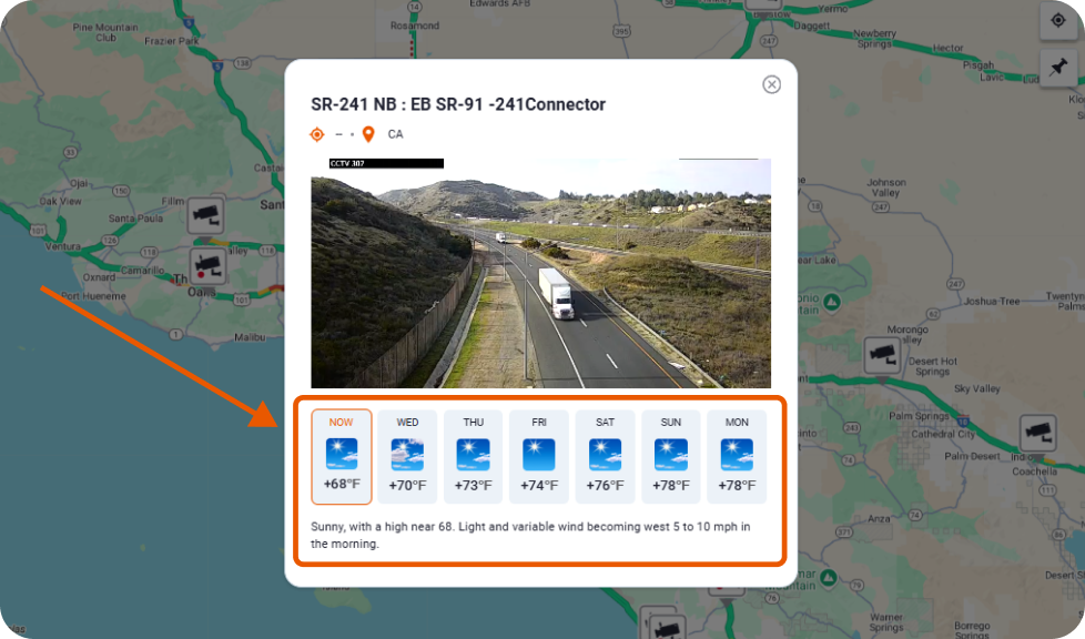
To make staying updated even more convenient, Trucker Guide offers a dedicated Trucker Guide Road Condition Forecast group. It keeps you informed about the latest weather updates and road alerts so you can make smarter decisions for every mile of your journey.
Having traffic, road, and weather visibility all in one place helps drivers avoid surprises and make calmer, better-timed choices on the road. That brings us to the locations truckers need to pay the most attention to this week.
Trending Traffic Camera Locations This Week
As of September 28, 2026, interest in live traffic cameras continues to climb, largely because weather and road conditions are harder to predict this time of year. Many drivers now rely on real-time traffic camera feeds not just for convenience, but because they genuinely help avoid nasty surprises on the road.
Traffic cameras in Seattle are particularly useful this week as construction continues across the Puget Sound region. The biggest weekend closures on southbound I-405 between Bellevue and Renton and at the I-405/Northeast 132nd Street interchange in Kirkland were scheduled to end early Monday, September 28. However, northbound I-5 across Seattle's Ship Canal Bridge remains reduced to two lanes through the end of 2026, and the Harvard Avenue on-ramp is scheduled to remain closed until mid-October.
Weather is another reason to check conditions before heading through Seattle. On September 28, the area had a mix of clouds and sun, with patchy fog possible in the morning and temperatures reaching the mid-60s. Rain and breezier conditions were expected to develop as another Pacific system moved into the region during the week.
Cincinnati traffic cameras can help truck drivers monitor conditions around downtown Cincinnati and the Brent Spence Bridge corridor this week. The major I-75 weekend closure for the Linn Street Bridge project ended early Monday, September 28, after crews completed the planned work. Northbound I-75 reopened Sunday night, while southbound lanes reopened around 4 a.m. Monday.
However, several ramp changes remain in place as construction continues, including a closure of the northbound I-71/I-75 ramp to Second Street that is scheduled to continue through fall 2028.
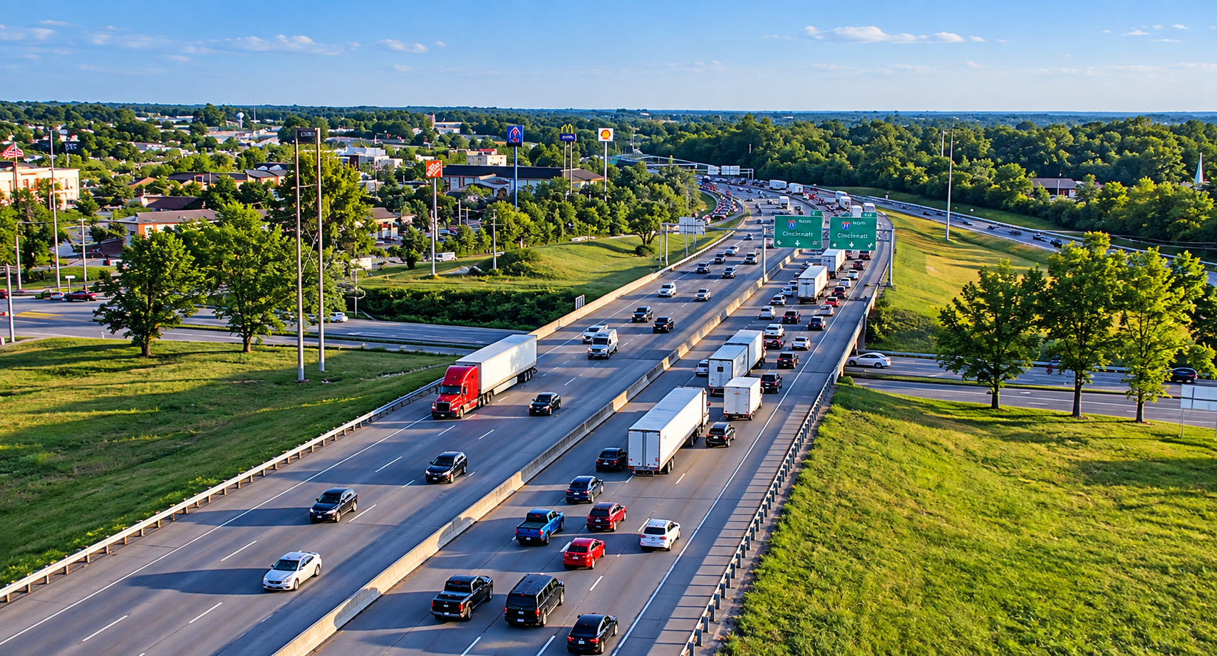
Because construction continues around the downtown corridor, checking Cincinnati traffic cameras before entering the area can help truck drivers see current traffic flow, backups, and lane conditions. This is especially useful after a major closure ends, when traffic patterns can change as drivers return to normal routes.
Meanwhile, traffic cameras in Los Alamos can help drivers monitor conditions around active construction on Trinity Drive. Los Alamos County's September 28 update reports that eastbound traffic is reduced to one inside lane between Oppenheimer Drive and Knecht Street. Crews are also continuing sidewalk, curb, gutter, and utility work on the westbound side. The project is scheduled to continue through December 18, 2026.
Weather is also important around Los Alamos this week. Rain and thunderstorms are affecting parts of New Mexico, increasing the need to watch for wet roads and changing travel conditions. When rain occurs around an active construction zone, a live camera can give truck drivers another way to check traffic and roadway conditions before entering the area.
Overall, the trend is clear. Drivers are no longer relying only on reports or forecasts. They use traffic camera networks to verify real-world conditions before making routing decisions.
Where Can Truck Drivers Check DOT Traffic Cameras Right Now?
Road conditions can change quickly, and for truckers, monitoring live feeds is an important part of trip planning. Accidents, sudden lane closures, fog, snow, and construction can appear with little warning, and checking cameras ahead of time helps drivers see conditions before those issues slow them down.
SCDOT traffic cameras can help truck drivers monitor current conditions across South Carolina through the state's 511 traveler information system. These tools provide traffic-camera views along with information about construction, maintenance, and emergency conditions.
For the week of September 28, SCDOT's road-condition system listed active interstate work. On I-26 in Charleston, overnight lane restrictions were scheduled for September 28–30, including bridge-maintenance work. On I-95 in Colleton County, additional northbound and southbound lane restrictions were scheduled from September 28 through October 1, while work in Dorchester County was scheduled for September 29–October 3. Several of these restrictions are weather-dependent.
In Delaware, DelDOT cameras provide another way to check current conditions around construction and traffic restrictions. DelDOT's interactive map includes traffic cameras, travel advisories, construction information, roadway-weather conditions, water-on-road information, and other travel data.
As of September 28, Salem Church Road in New Castle County remained closed in both directions between US-40 and Cornell Drive for completion of the Salem Church Road roundabout. The closure began September 21 and is scheduled to continue until October 7. DelDOT advises drivers to allow extra travel time and notes that the construction is weather-dependent.
For drivers approaching the area, DelDOT cameras can provide a useful visual check before entering an affected corridor. Drivers can compare the live camera view with current advisories and construction information to get a clearer picture of conditions ahead.
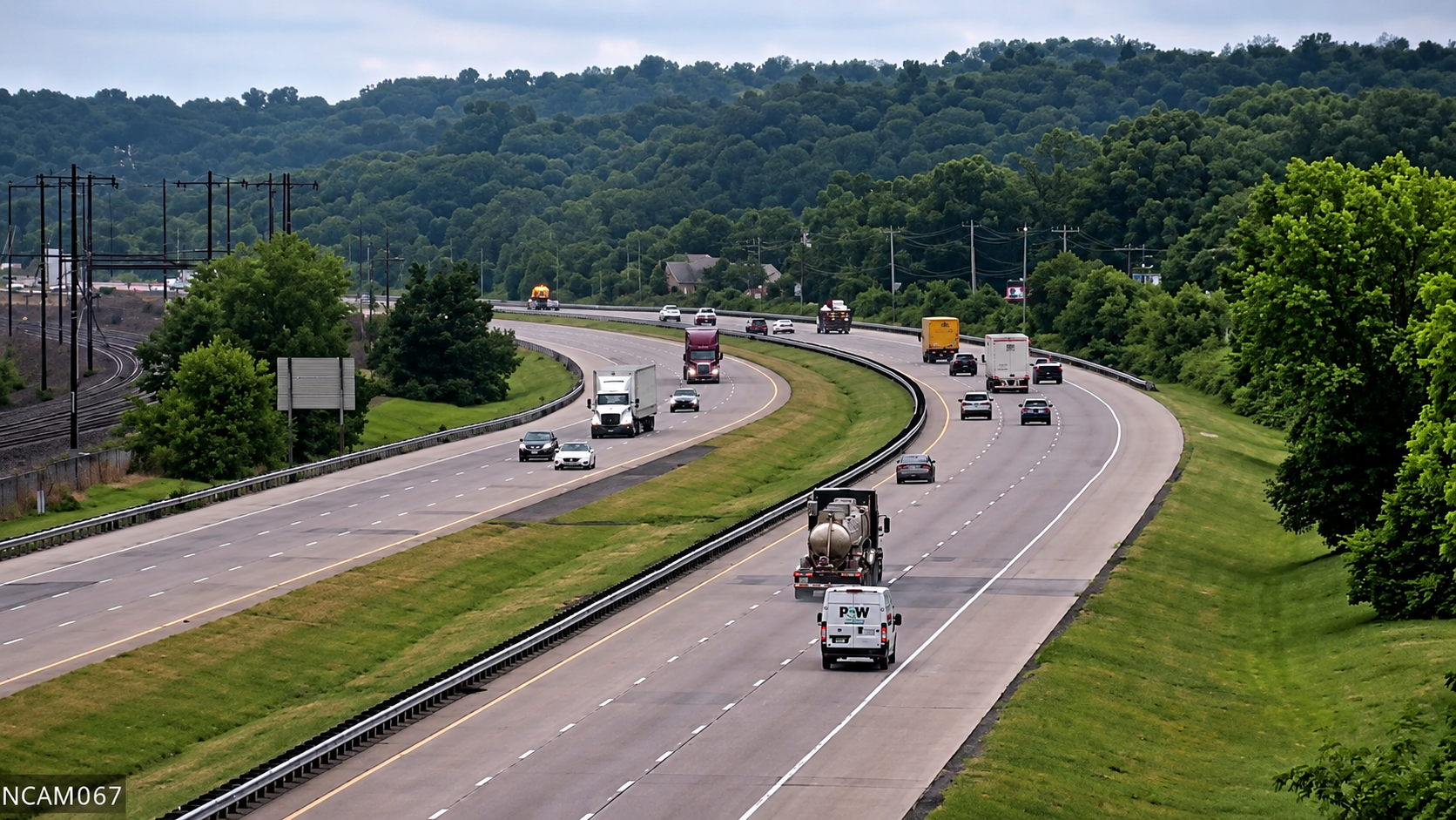
Along Minnesota freight routes, MnDOT traffic cameras can help truck drivers monitor traffic and construction before entering busy highway sections. It provides access to traffic cameras, road events, commercial-vehicle restrictions, and weather stations, allowing drivers to check several types of travel information in one place.
One current example is the I-35 tunnel project in Duluth. MnDOT began concrete-grinding work in the I-35 tunnels on September 28, with intermittent single-lane traffic during work hours. A full-day closure of the I-35 northbound on-ramp and southbound off-ramp at Lake Avenue is also planned for midweek. The project is expected to continue through October 8. For truck drivers traveling through Duluth, checking MnDOT traffic cameras before entering the I-35 tunnels can help show whether traffic is moving normally or whether lane restrictions are creating delays.
Combining the camera view with current weather information gives drivers a more complete picture of the route ahead.
Which Interstate Highways Have the Most Active Camera Monitoring?
Some highways always get extra attention because of how long they are, how busy they get, or the tricky weather they can bring. Watching interstate cameras along these routes gives drivers a clear picture of what’s happening on the road, so they can plan smarter and stay safer.
Here are a few that are especially important:
- I-25 runs north to south through Colorado, Wyoming, and New Mexico, connecting major freight hubs like Denver, Colorado Springs, and Cheyenne. The route crosses a mix of urban corridors, open plains, and higher-elevation stretches where weather conditions can change fast, especially during winter and early spring.
Using I-25 traffic cameras helps drivers check current pavement conditions, monitor traffic flow, and spot incidents before heading into congested metro areas or exposed stretches where weather can create unexpected delays.
- I-75 – Stretching from the Great Lakes down to Florida, I‑75 passes through diverse terrain and weather zones, including heavy rain in the south and occasional snow or ice in the north.
Monitoring traffic cameras along I-75 allows drivers to verify pavement conditions, visibility, and traffic flow before committing to long stretches between major hubs.
- I-80 – One of the most important east–west freight corridors in the country, I-80 runs from California all the way to New Jersey, cutting through a mix of flat plains, mountain passes, and high-elevation stretches. That variety is exactly why conditions can change so fast depending on where you are on the route.
Using I-80 traffic cameras is especially useful in places like Nevada, Utah, Wyoming, and Pennsylvania, where the weather can change quickly, and visibility can drop with little warning. One section might be clear and dry, while just a few miles ahead, you could be dealing with snow, fog, or heavy wind.
- I-90 – As the longest interstate highway in the United States, I-90 stretches from Seattle, Washington, to Boston, Massachusetts, crossing mountain passes, wide-open plains, the Great Lakes region, and densely populated urban corridors. Because it spans so many climate zones, drivers can encounter everything from heavy snow in the Cascades and northern Rockies to lake-effect snow in the Midwest and rain in the Northeast.
Using I-90 traffic cameras helps drivers check real-time road conditions, visibility, and traffic before traveling through mountain passes, major metro areas like Seattle, Chicago, and Cleveland, or regions where weather and traffic conditions can change rapidly.
Before your next trip, take a few minutes to check the Trucker Guide’s DOT cameras live. A small investment of time now can save hours on the road, reduce stress, and keep both you and your rig safe.
Stay aware, stay prepared, and keep moving with confidence.
Frequently Asked Questions
Which app shows live road cameras for truck drivers?
Trucker Guide provides access to thousands of live DOT and highway camera feeds across the U.S. and Canada, making it one of the most complete tools for real-time road visibility in a single platform.
Can I see live highway cameras before I start driving?
Yes. Drivers can check live feeds before a trip to see traffic flow, weather conditions, and incidents along the route, helping them choose better timing or adjust plans before departure.
How is Trucker Guide different from 511 traffic systems?
Unlike many state-only 511 systems, Trucker Guide combines multiple DOT feeds and highway cameras across all states and Canada in one platform, giving drivers broader, unified access instead of switching between state sites.
How do I check road conditions on a specific state or city before my trip?
You can search live camera feeds by highway, region, or location in the app or web platform to quickly see real-time traffic and weather conditions before you start driving.
Does Trucker Guide have traffic cameras in Canada?
Yes. The platform includes live road camera coverage across both the U.S. and Canada, helping drivers monitor cross-border routes and major freight corridors.
Do I need a paid subscription to access live traffic cameras in Trucker Guide?
No. Live camera access is available directly through the platform, allowing drivers to check road conditions without requiring a paid subscription.


