



7 Routing Checks for Truck Navigation App in 2026

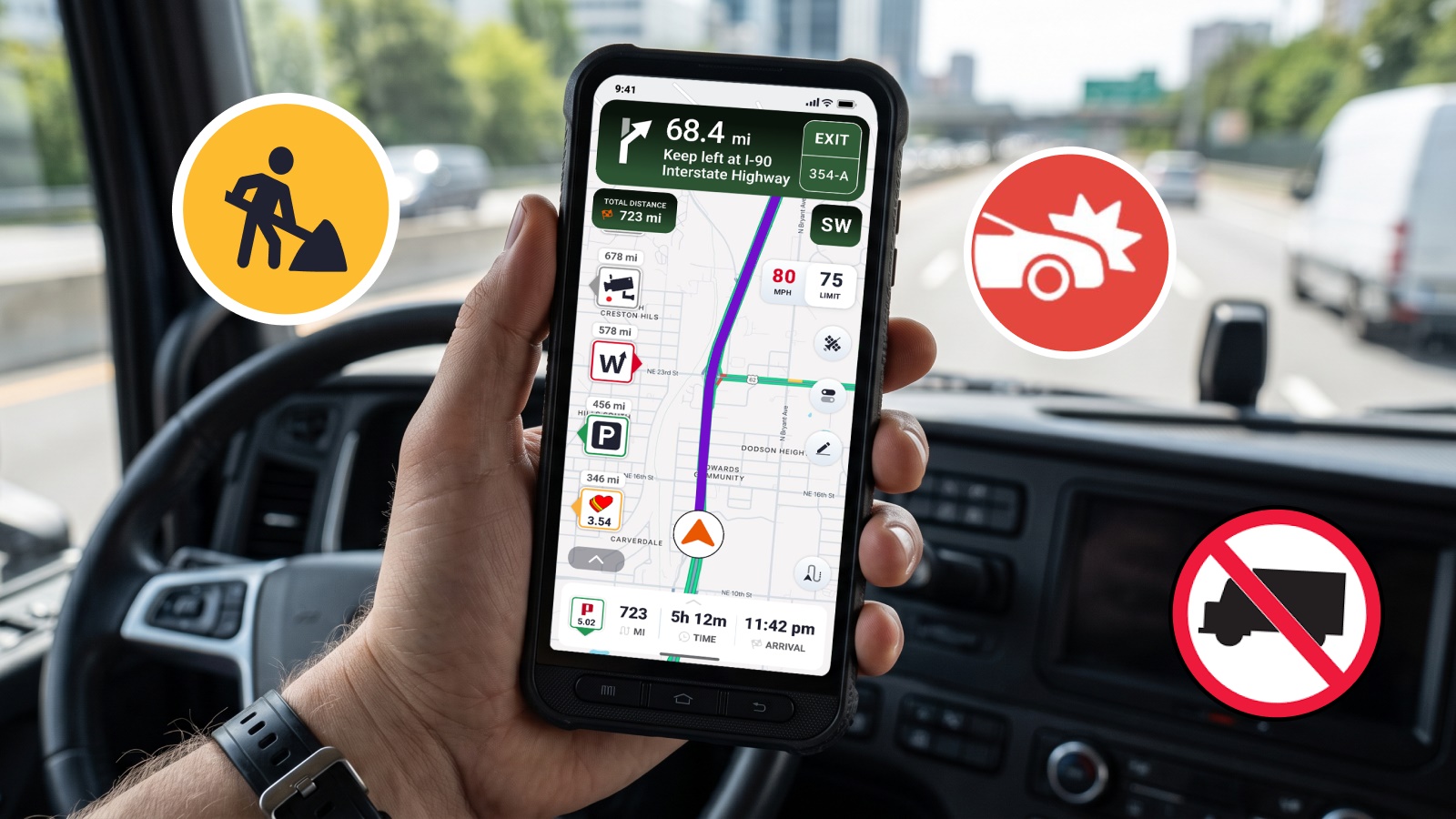
The seven essential routing checks for truck navigation apps in 2026 are: truck profile matching, no-truck road avoidance, bridge height clearance handling, real-time road updates, full trip planning support, real-time status updates, and offline navigation capability. These checks ensure your GPS app provides safe, legal, and efficient routes designed specifically for commercial vehicles.
Many drivers start with general navigation apps or look for Trucker Path alternatives after experiencing problems such as incorrect truck routes, missing low-clearance warnings, outdated parking information, or limited commercial vehicle support. Unlike consumer navigation tools, trucking navigation apps must account for vehicle dimensions, road regulations, fuel planning, parking availability, weigh station information, and the daily challenges of operating a commercial vehicle.
Trucker Guide | Navigation was created around these needs. Instead of treating a tractor-trailer like a larger passenger vehicle, it helps drivers plan routes based on truck requirements, road restrictions, 450K+ truck-friendly locations, and the tools needed throughout a long haul.
Below are seven essential commercial vehicle routing checks every driver should use when evaluating a truck navigation app in 2026.
Key Facts:
- 80,000 lbs: Maximum gross vehicle weight on Interstate highways under federal standards
- 13 ft 6 in: Typical tractor-trailer height requiring clearance-aware routing
- 80 ft: Maximum combination length depending on truck configuration
- 15,000+: Bridges and tunnels in Trucker Guide's Low Clearance Map database
- 450,000+: Trucker-friendly points of interest including truck stops, rest areas, weigh stations, and parking locations
- 13-15%: Major highways in North America with unreliable or no cell service coverage
- 2,000-3,000 miles: Average weekly distance covered by long-haul drivers
1. Does the Route Fit Your Truck's Profile?
Any serious discussion about truck navigation apps has to start with the most important question. Does the tool know what you drive and use that information in routing from the first step?
Two drivers can leave the same terminal, headed to the same customer, in completely different trucks. One is running a day cab with a 53‑foot dry van at 75,000 pounds. The other is in a sleeper with a step‑deck and specialized equipment that pushes both length and height close to the limits. A car‑based app will give them the same route. A true truck navigation app will not.
Federal standards allow up to 80,000 lbs gross vehicle weight on Interstates, with many tractor‑trailers around 13 ft 6 in tall and combinations near 80 ft long depending on configuration. These numbers determine whether a road, ramp, or terminal entrance is usable.
In Trucker Guide | Navigation, every route is built around your truck profile from the first screen. Before you hit "Go," you define the vehicle you are actually driving. Height, length, width, weight, and trailer configuration become the foundation of every route.

For drivers carrying regulated cargo, this matters even more. Certain tunnels, parkways, and urban corridors restrict hazardous materials even when they allow general truck traffic. Trucker Guide incorporates those considerations so your route reflects both your physical size and your load type.
2. Does the App Avoid No-Truck Roads?
No‑truck restrictions are everywhere. Parkways with scenic intent, residential neighborhoods trying to limit commercial traffic, urban cores with designated truck routes, and specific tunnels or bridges that ban certain classes of trucks.
A generic navigation app sees these as normal roads. It does not care that your truck is prohibited there.
A reliable truck GPS must actively avoid no‑truck roads, parkways, and residential truck bans when building routes. It must respect urban truck route networks and designated no‑through‑truck zones.
With Trucker Guide | Navigation, you have full control over which road types or obstacles you want to bypass. When you set your truck profile, the app avoids options that are unsuitable for commercial vehicles, such as parkways, certain residential streets, and roads with explicit truck bans.

Once your preferences are set, the system generates a route that aligns with your truck's requirements and your driving preferences. This means you spend less time second-guessing your path and more time focused on the road ahead.
3. Does Navigation Handle Bridge Height Clearance?
Your truck height is only useful if the app uses it to keep you away from low bridges. Bridge height clearance is where theory meets metal. A map might say "truck route," but if the overpass ahead is 12 ft 9 in and your truck is 13 ft 4 in, the result is a strike, a shutdown, and potentially serious consequences.
In Trucker Guide | Navigation, your truck height is part of the core profile used for every route. When the system calculates options, it avoids roads and bridges with clearances below your entered height and prioritizes corridors that are known to accommodate modern commercial vehicles.
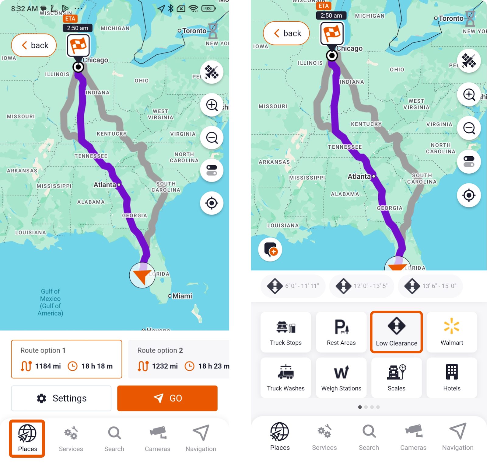
The app integrates a comprehensive Low Clearance Map that provides detailed information about more than 15,000 bridges and tunnels nationwide. This map is regularly updated to reflect changes or new additions to road layouts, ensuring you always have accurate clearance data.
From the bottom menu in the app, you can open the Places section and select the Low Clearances icon to display all low bridges along your route. This feature allows you to see potential hazards before you reach them, giving you time to adjust your route or prepare for alternate paths.
4. Does the App Provide Real-Time Road Updates?
Traffic matters to every driver, but truckers need more than "red means slow." A closure that adds 10 minutes for a car might force a 45‑minute detour for a truck if it blocks a key freight corridor. Construction that narrows a ramp can turn a standard interchange into a no‑go for long combinations.
For professional drivers, the impact shows up as being sent into a jam that is passable for cars but risky for a big rig, missing better truck‑safe alternates, and facing weather‑related hazards on segments that should have been avoided.
A truck‑grade navigation tool must provide live traffic and road condition updates that reflect truck speeds, grades, and restrictions. It must alert you to construction, closures, and detours that affect truck lanes and access points.
In Trucker Guide | Navigation, the system integrates real‑time road updates designed for commercial drivers. The app provides live traffic, weather, and road condition information, including access to thousands of traffic cameras so you can see conditions ahead in real time.

When you rely on real‑time updates during a long haul, focus on these aspects. Use live traffic cameras to verify conditions before you commit to a re‑route. Pay attention to weather alerts on high‑wind and steep‑grade segments.
5. Does GPS App Support Full Trip Planning?
Long‑haul driving is not just about getting from point A to point B. It is about planning fuel, rest, parking, and overnight stops around hours‑of‑service rules, customer appointments, and personal preferences. A turn‑by‑turn app that only does point‑to‑point navigation leaves you to stitch the rest together manually.
You may end up with a perfect route but no safe place to park for the night, or a fuel stop that forces a long, inefficient detour off your truck‑safe corridor. A complete truck navigation platform must support multi‑stop trip planning with pickups, deliveries, fuel, rest, and home base in a logical order.
In Trucker Guide | Navigation, the system is designed as a full trip‑planning tool, not just a navigator.
You can build multi‑stop routes with all your key waypoints, customers, terminals, fuel, preferred truck stops, and adjust them anytime as your day changes. The app taps into more than 450,000 trucker‑friendly points of interest, including truck stops, rest areas, weigh stations, service centers, and parking locations.
6. Does the App Provide Real-Time Status Updates?
Knowing what is ahead before you arrive can save you time, fuel, and compliance headaches. Professional drivers rely on accurate weigh station maps and live location updates to prepare for inspections and avoid unnecessary delays.
Professional drivers need real-time updates on critical information: Is the truck stop full? Is the weigh station open or closed? Is that restaurant still operating? These details directly impact your schedule, fuel costs, and compliance with hours-of-service rules.
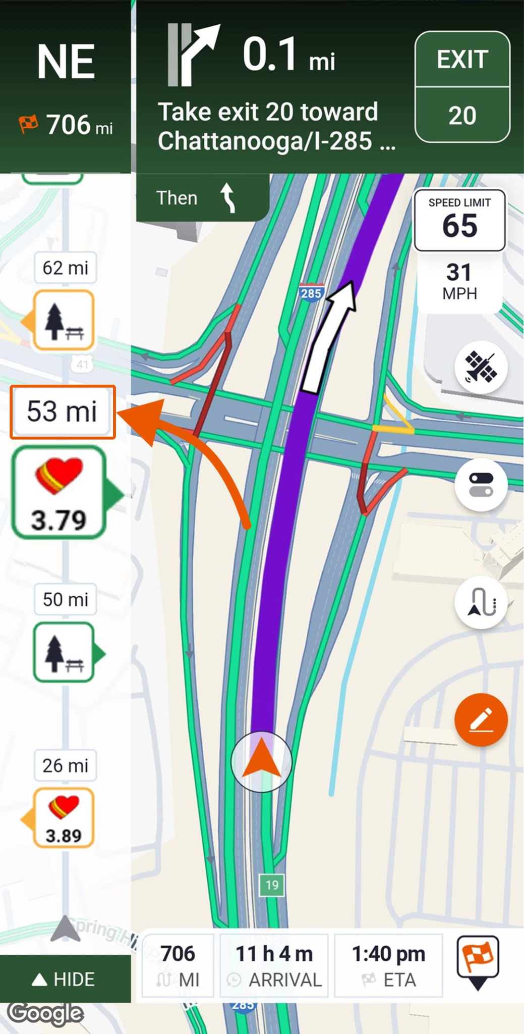
In Trucker Guide | Navigation, the system integrates real-time status updates from thousands of locations nationwide. You get live information on:
- Parking availability at truck stops, rest areas, and public parking locations, helping you meet rest break compliance.
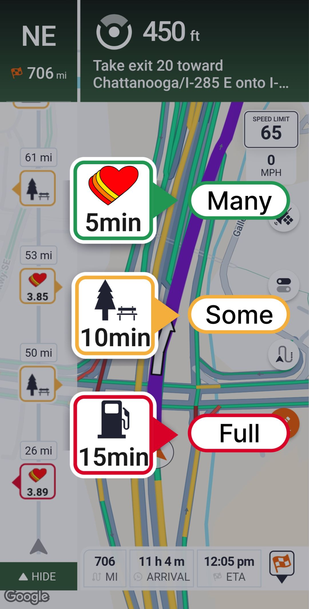
- Weigh station status updates showing whether stations are open, closed, or under DOT inspection.

- Fuel price updates with real-time pricing across the USA and Canada, allowing you to compare and find the best deal along your route.
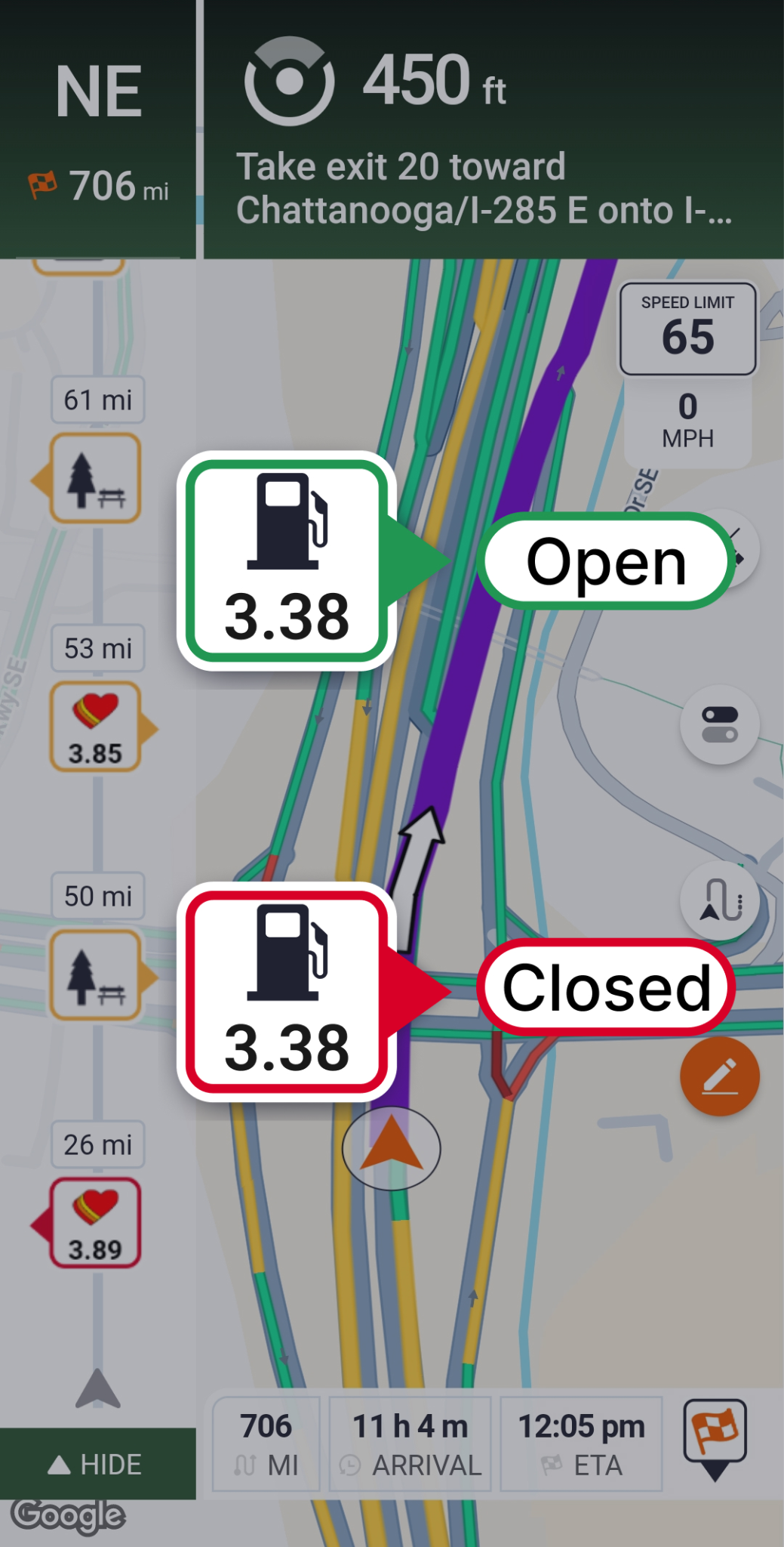
- Business status updates showing whether locations are open or closed.
The app also enables community-driven updates. When you arrive at a weigh station, or truck stop, you can submit your own status update to help other drivers.
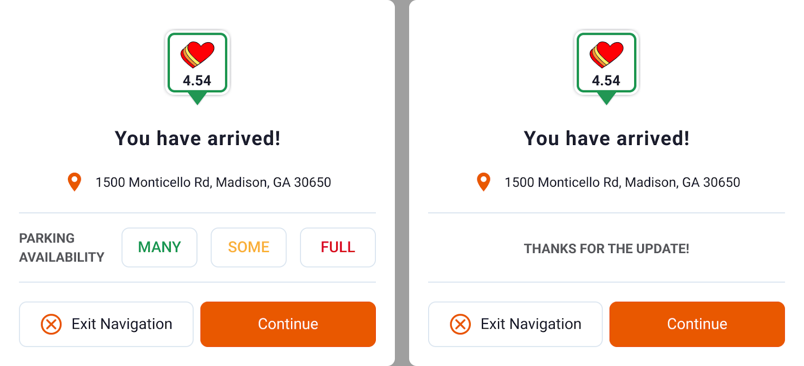
This creates a trusted network of live information that keeps the entire trucking community informed.
7. Does Navigation Work Without Internet Connection?
Long-haul routes often take you through areas with spotty cell service. A navigation app that stops working the moment you lose signal is a liability, not a tool.
According to recent data, approximately 13 to 15 percent of major highways in North America have unreliable or no cell service coverage. For long-haul drivers covering 2,000 to 3,000 miles per week, this translates to hundreds of miles where standard navigation apps fail.
Professional drivers need an app that continues to provide turn-by-turn directions, speed limit alerts, and route guidance even when offline. Critical features like rerouting, POI search, and truck restrictions should remain accessible without an internet connection.
In Trucker Guide | Navigation, offline mode keeps your route active even when you lose signal. Turn-by-turn directions, speed alerts, and previously loaded POIs remain functional, so you are never left navigating blind in dead zones. The app processes route data locally on your device, which means core navigation features continue working without requiring an internet connection.
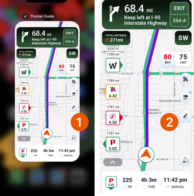
Instead of relying on constant connectivity, Trucker Guide is built to support you through every mile, whether you are on a major highway or a remote backroad.
Ready to Upgrade Your Truck Navigation Experience?
If you are comparing trucking navigation apps or searching for a reliable alternative to standard GPS tools, Trucker Guide | Navigation provides the truck-specific features professional drivers need.
From route restrictions and low-clearance warnings to diesel fuel planning, truck parking locations, weigh station visibility, and 450,000+ truck-friendly points of interest, Trucker Guide helps drivers make better decisions before and during every haul.
Start your 7-day free trial today and experience the difference commercial-first routing makes on your next haul.
Frequently Asked Questions
Which truck navigation apps handle bridge heights and truck weight limits best?
Trucker Guide | Navigation uses your truck profile to avoid low bridges, weight-restricted roads, hazardous material restrictions, and other routes unsuitable for commercial vehicles. It also includes a low clearance map with information on more than 15,000 bridges and tunnels.
Which truck navigation apps avoid low bridges and no-truck roads?
Trucker Guide | Navigation combines truck dimensions with road restrictions to generate legal, truck-safe routes while helping drivers avoid clearance issues and prohibited roads.
How do I avoid no-truck roads and parkways in my GPS routing?
Enter your truck's dimensions and weight, and the app will calculate routes that bypass truck-restricted roads, parkways, residential streets, and other prohibited areas while following designated truck routes whenever possible.
Do truck navigation apps work offline without an internet connection?
Trucker Guide | Navigation continues providing turn-by-turn directions, speed limit alerts, and truck-specific guidance even when internet service is unavailable, making it useful for long-haul routes through remote areas.
How many truck-friendly locations do navigation apps include?
The number varies by app. Trucker Guide | Navigation includes access to more than 450,000 truck-friendly locations across North America, including truck stops, fuel stations, rest areas, weigh stations, parking locations, service centers, and other points of interest that support trip planning for commercial drivers.


