



Live Weigh Station Status: A Trucking Locator for U.S. Dispatchers

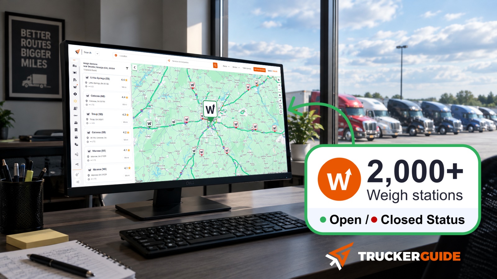
Trucker Guide weigh station locator is the truck-specific solution for dispatchers who need real-time open and closed scale visibility across U.S. routes. It provides 2,000+ weigh station locations across the United States, including available open/closed status information.
But what should dispatchers actually look for in a weigh station locator, and how can this information fit into everyday route planning? Let’s look at the key details and how Trucker Guide brings them together in one place.
Quick Summary:
- Trucker Guide lists 2,000+ weigh stations to help dispatchers find facilities across U.S. routes.
- The directory covers all 50 states, making it useful for planning routes across the United States.
- Open/closed status is available so dispatchers can review the current information shown for stations along a route.
- Trucker Guide includes 450,000+ POIs for finding additional truck-related services during a trip.
- Truck-specific routing helps dispatchers plan commercial-vehicle routes with weigh stations and other stops in mind.
- Traffic cameras, truck parking, and fuel information provide additional resources for monitoring and planning truck routes.
Why Does Weigh Station Information Matter to Dispatchers?
Weigh stations are part of the commercial-vehicle enforcement system. Fixed facilities may be used for weight checks, safety inspections, and reviews of credentials, permits, and other compliance requirements.
The Federal Highway Administration (FHWA)* describes fixed weigh stations as an important part of many states’ truck size-and-weight enforcement programs. FHWA also explains that electronic screening systems can allow eligible trucks to be screened without stopping at the station.
For dispatchers, this makes weigh-station information useful for route planning. Knowing a station’s location, operating information, and available open or closed status can help dispatchers better understand what to expect along a planned route.
A dispatcher may need to:
✔️ Identify weigh stations along a planned route.
✔️ Review the available status information for those locations.
✔️ Consider weigh stations when coordinating a multi-state trip.
✔️ Check nearby services that a driver may need during the same trip.
✔️ Monitor traffic and route conditions while the truck is on the road.
Having these details in one truck-focused planning environment can reduce the need to search for each type of information separately.
The Federal Highway Administration (FHWA) is a U.S. government agency under the U.S. Department of Transportation (USDOT). It focuses on highways, road infrastructure, and transportation programs across the United States.
What’s the Difference Between Weigh Stations and Truck Scales?
Weigh stations and truck scales both involve vehicle weight, but they serve different purposes. A weigh station is generally part of the commercial-vehicle enforcement system and may involve weighing, safety inspections, credential checks, and other compliance checks.
A truck scale, by comparison, is primarily used to obtain a vehicle or load weight and may be privately operated. For dispatchers, the distinction matters because the type of facility determines what the location is useful for during route planning.
Trucker Guide keeps weigh stations and truck scales as separate categories, helping dispatchers quickly find the type of facility they need for each route.
What Does Trucker Guide's Weigh Station Locator Show?
For dispatchers, Trucker Guide is a truck-specific weigh station locator built around commercial-vehicle route planning. It covers 2,000+ weigh station locations across all 50 states, with available open/closed status information shown for listed stations.
The platform also brings weigh stations together with other truck-related information that can be useful when planning a trip.
The value for dispatchers is not simply having more weigh stations on a map. It is having weigh-station information alongside the other details needed to manage a commercial-vehicle route. A dispatcher can identify stations along a trip, review the status information shown for each location, and keep fuel, parking, maintenance, traffic, and other truck-related stops in the same planning environment.
How Does Weigh Station Bypass Information Work?
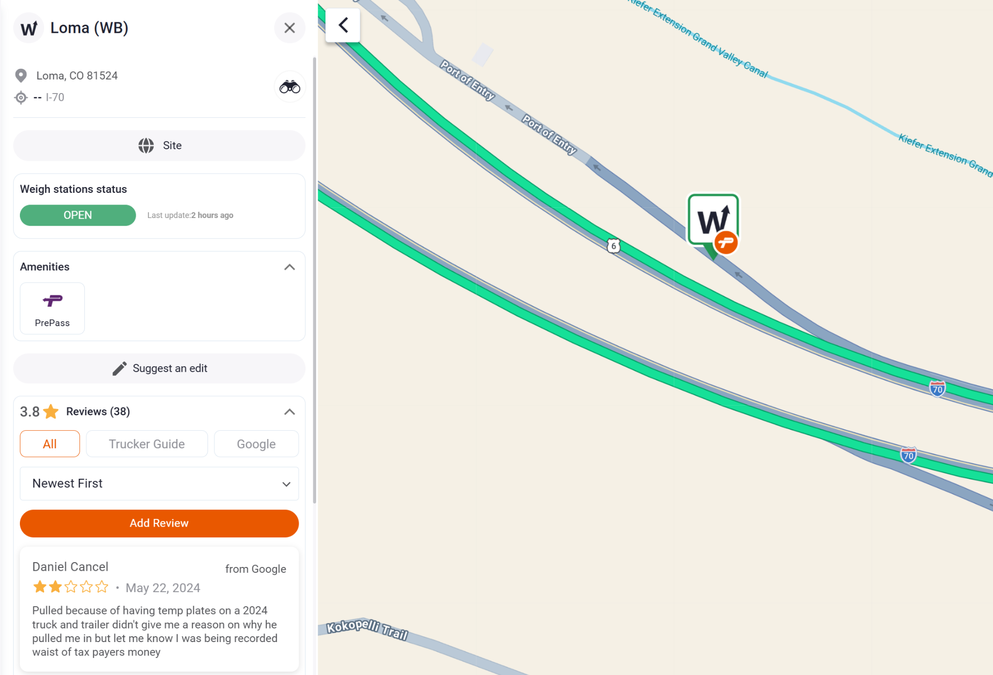
Trucker Guide makes it easier for dispatchers to spot weigh stations with bypass locations along a route. Special icons on the map identify these locations, making them easier to recognize when reviewing a trip.
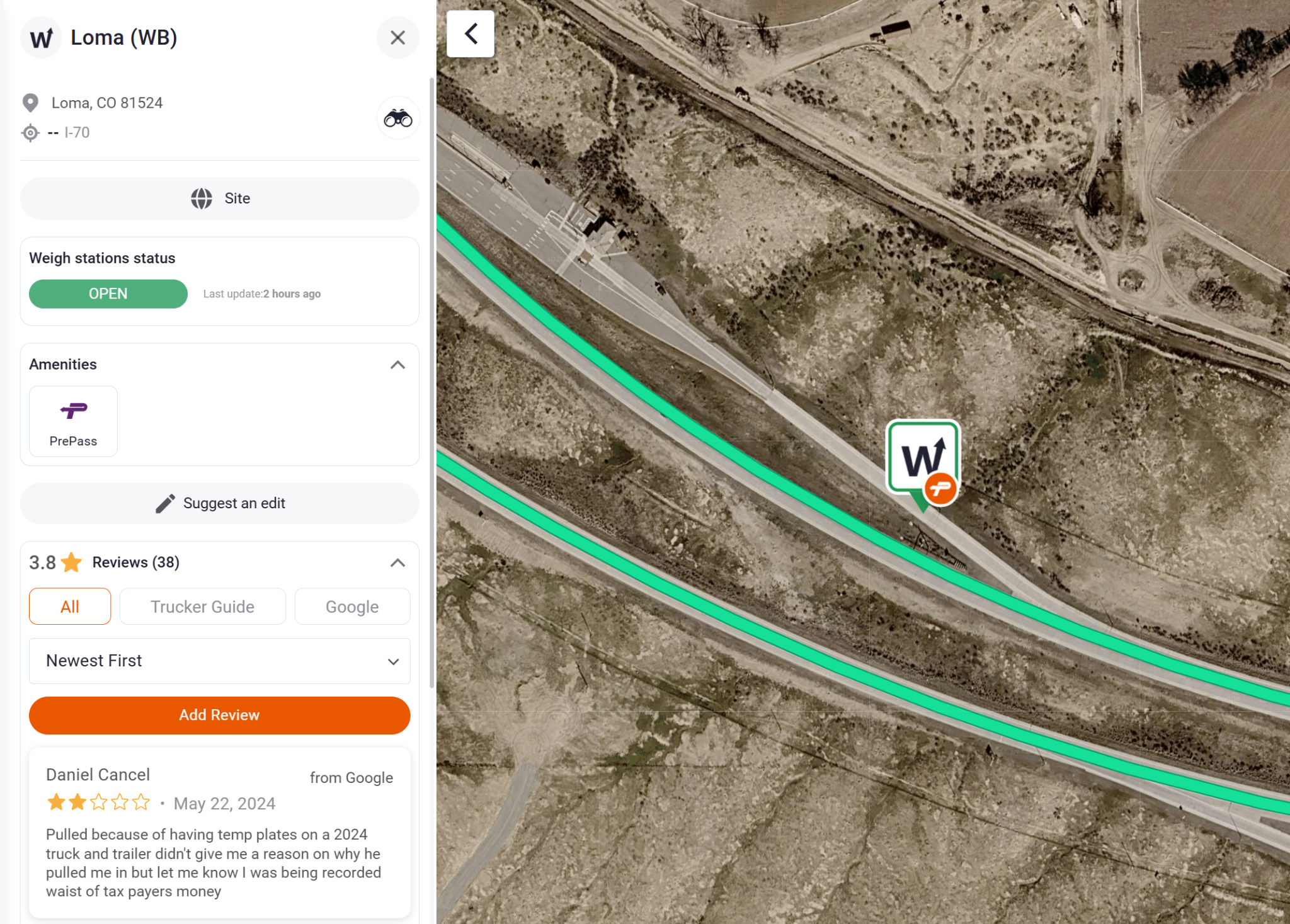
Dispatchers can also switch between a broad route view and detailed satellite view to see where a weigh station sits along the highway.
The distinction between a bypass location and bypass authorization is important. The map helps dispatchers identify where bypass-enabled weigh stations are located, while the applicable electronic screening system determines whether a particular truck is authorized to bypass. For example, systems such as PrePass handle electronic screening and bypass decisions. Trucker Guide's map indicators provide location information so dispatchers can recognize relevant weigh stations during route planning.
How Can Dispatchers Use Weigh Station Status During Route Planning?
A truck-focused locator can be part of the normal dispatch workflow rather than a separate search for weigh stations.
1. Find weigh stations. Use the map to identify stations along the planned route.
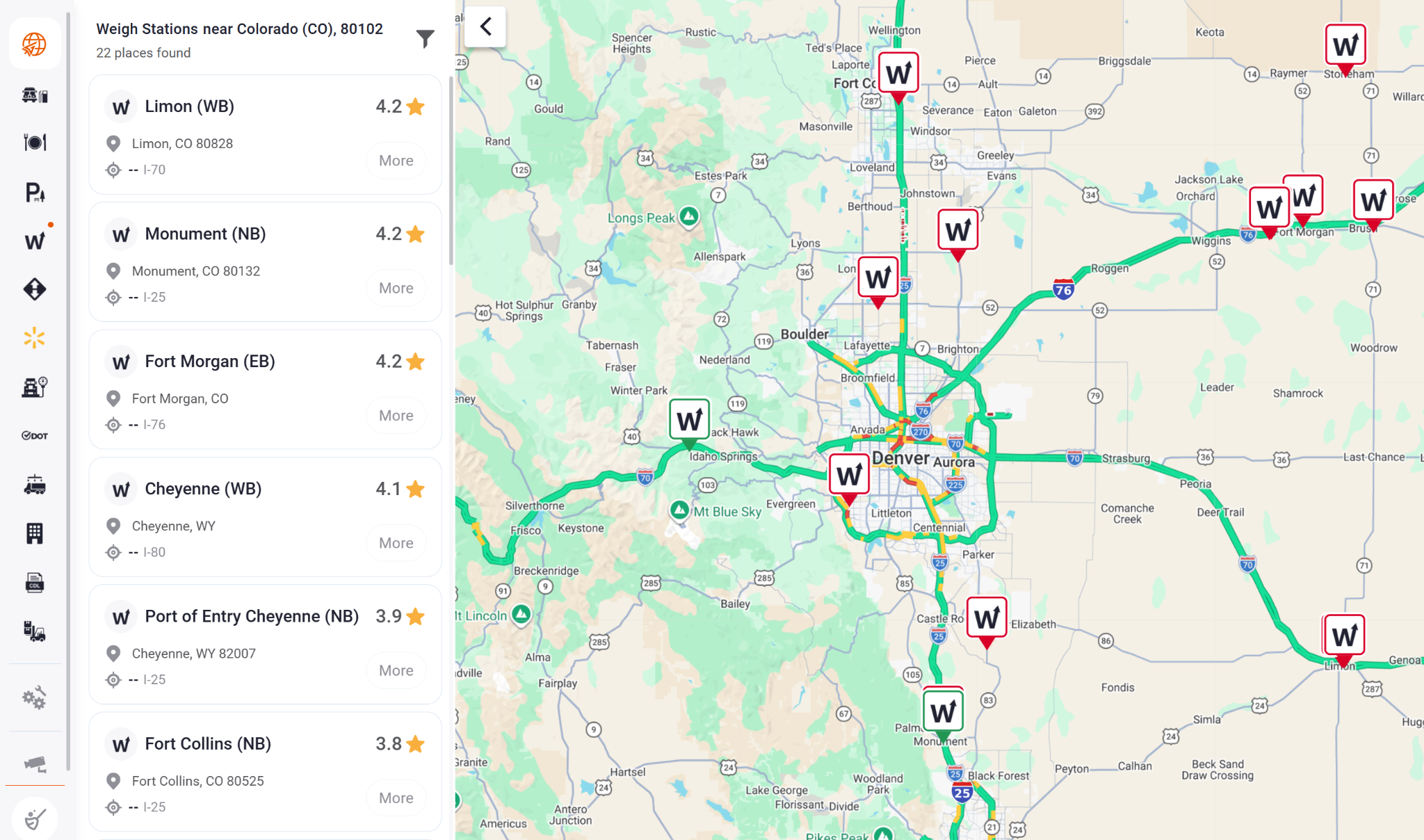
2. Review status. Check the displayed open or closed status for weigh stations along the planned route to see their current listed working status.
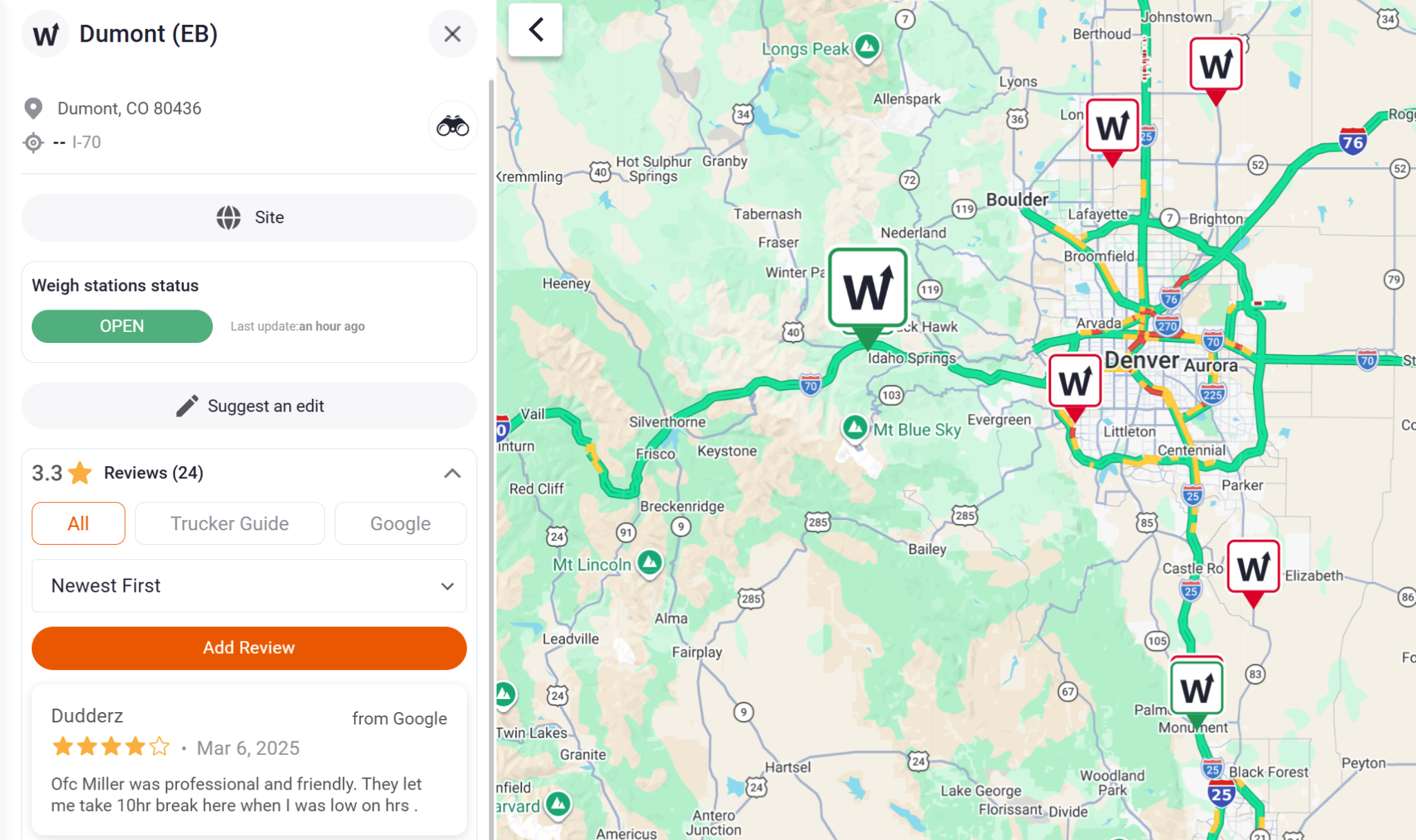
3. Check bypass locations. Look for the special map icons that mark weigh stations with bypass locations, making them easier to identify along the planned route.
4. Use satellite view. Switch to satellite view to see the weigh station’s exact position along the highway and better understand its location in relation to the planned route.
The weigh station icon is often placed near the station entrance, helping dispatchers identify where trucks enter the facility.
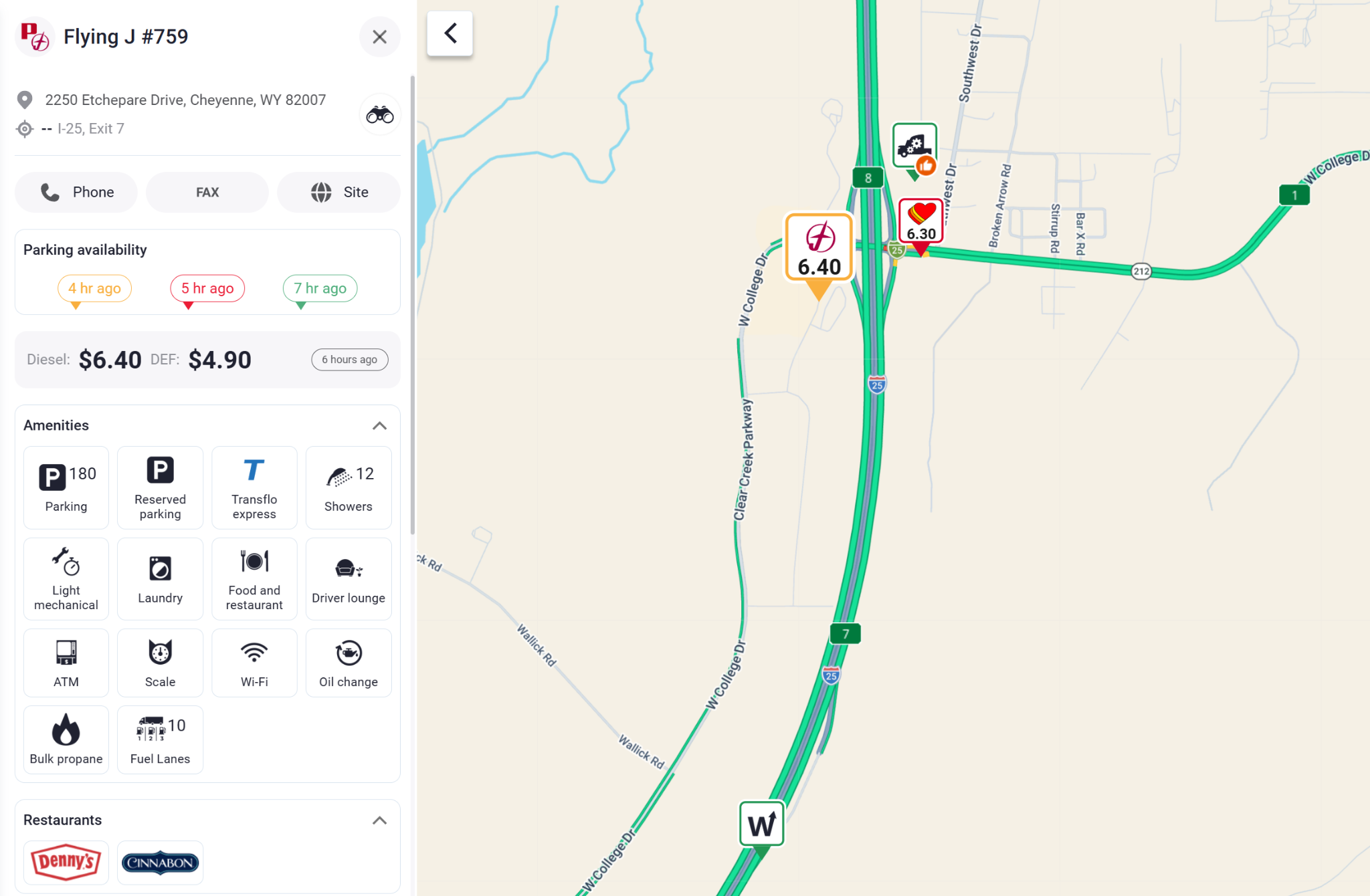
5. Check route services. Find fuel stops, truck parking, maintenance facilities, and other essential truck services along the planned route to help coordinate stops before and during the trip.
6. Coordinate the trip. Use the information gathered from the map to organize the planned route and relevant stops.
This workflow makes weigh-station information part of the overall route-planning process. Instead of searching for each station separately, dispatchers can check station locations, open/closed status, bypass indicators, and nearby truck services while planning the same trip.
Ready to Plan Your Next U.S. Route?
With Trucker Guide, dispatchers can find 2,000+ weigh station locations, review available open/closed status information, identify bypass locations, and search for truck-related services along the route.
Explore Trucker Guide's weigh station locator and keep the information connected to the rest of your route planning.
Frequently Asked Questions
What is a weigh station locator?
A weigh station locator helps truckers find weigh stations and check their locations and status along a route.
What is the best weigh station locator app for truckers in the United States?
Trucker Guide combines weigh station information with truck-specific navigation and route-planning tools. Drivers can use the app to locate weigh stations while planning routes across the U.S.
Which apps show weigh station open or closed status?
Trucker Guide provides current open or closed status for listed weigh stations, helping drivers check station availability when planning or following a route.
How can dispatchers use weigh station information?
Dispatchers can use Trucker Guide to identify weigh stations along planned routes, review available status and bypass information, and factor these stops into commercial-vehicle trip planning.
What's the difference between a weigh station and a truck scale?
A weigh station is generally associated with commercial-vehicle enforcement and may include weighing and compliance inspections. A truck scale is primarily used to measure vehicle or load weight and may be privately operated.


